By comparing physical structures, GIS-based viewsheds and computed skyscapes of several roundels throughout central Europe, we attempted to understand the spread of knowledge transfer within the “Kreisgraben-phenomeon” of the early 5th millennium BC.
Research
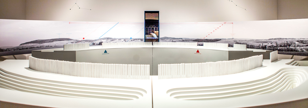
Model of the Ippesheim roundel, Germany. The openings in the palisade document the cardinal points of the sun during solstices and / or equinoxes / Source: Ausstellung Jenseits des Horizonts (2012) / Photo: Dunja Antić
Circular enclosures, so-called ‘Kreisgrabenanlagen’ or ‘roundels’ are a much discussed archaeological phenomenon of the early 5th millennium BC, occurring between western Hungary and central Germany. Their consistent appearance is characterized by circularity, concentric v-shaped ditches up to 4 m depth with one or more narrow entrances or causeways and accompanying palisades around a noticeably empty interior. Although these monuments seem to comply with a common set of architectural rules, they can be characterized by a great variability of their formal variants and construction details which do not seem to follow regional patterns, contradicting current models of spatial differentiation of material culture and hindering their overall interpretation. As many of the entrances of the enclosures –often differing in design – seem to be oriented towards astronomical phenomena, most frequently to the cardinal points of the sun during solstices and / or equinoxes, they have been interpreted as solar observatories, calendar buildings, cult or meeting places. However, more recent studies incorporating the real topographical location as well as the effective visible horizon challenge this perception. Since some enclosures are, in fact, orientated not only towards astronomical phenomena, but also towards topographic landmarks, it appears that the location of the roundels was not chosen randomly, but intentionally. Currently, they are interpreted as multifunctional constructions that were predominately used for cultic-religious purposes but also served socio-political tasks.
Given the short life span of the transcultural Kreisgraben-phenomenon, which emerged within a mere 200 years between western Hungary and central Germany, the dynamics of dissemination of the required geometrical-geodetic and astronomical knowledge are yet unknown. Furthermore, their occurrence raises even more questions as they are not distributed evenly at regular intervals but appear to be clustered in certain areas, opposing possible interpretations as central places.
Within a newly implemented project (November 2017 – December 2018) , funded by the Excellence Cluster Topoi, we intended to expand our previous research that dealt with the spatial and visual characteristics of 29 roundels in Germany. Based on high-resolution digital elevation models, areas possibly orientated towards topographical and astronomical features were systematically investigated using GIS-based viewsheds and computed skyscapes and a self-developed Python based routine that incorporates the visible horizon as seen from the enclosure.
On the basis of random samples from the entire distribution area of the roundels, we examined whether similar topographical and astronomical orientation of the gates can also be verified in other regions. Then, a limited number of criteria (e.g. design and orientation of the gates, size, number of ditches etc.) were selected to assess the structural variability of the enclosures. By means of suitable multivariate methods like cluster analysis, multidimensional scaling, and network analysis, these criteria were used to calculate the degree of generalized similarity between all samples comparing them with their respective geographical distances. The evaluation of these two variables, spatial distance and formal similarity, as well as their cartographic implementation by means of GIS, might be helpful to weigh between different conceivable models for the transfer of knowledge and the spread of this architectural concept.
Therefore, by comparing physical structures, GIS-based viewsheds and computed skyscapes of several roundels throughout central Europe, we attempted to understand the route of knowledge transfer as well as depict possible cultural interactions and communication networks.